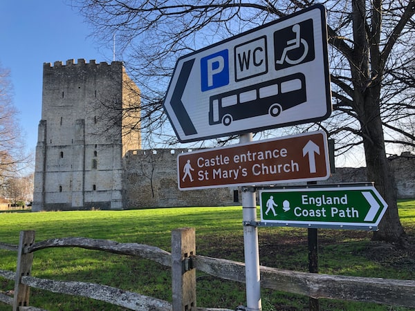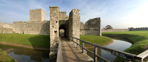
Portchester Castle sits along the the King Charles III England Coast PathBrendan Sainsbury/The Globe and Mail
The January sun sparkled on the rippled waters of Portsmouth harbour, turning its glassy surface into a crumpled piece of tinfoil.
On the horizon, I could see the tall, curvaceous silhouette of Portsmouth’s Spinnaker Tower to the south, while behind me, the jagged walls of Portchester castle rose commandingly above the shore as they have since Roman times.
I’d come to the historic shores of southern Hampshire to sample a small section of the U.K.’s newest attraction: the King Charles III England Coast Path. Almost complete and aiming to be the longest coastal walking path in the world when it’s finished later this year, the meandering trail will stretch for more than 4,300 kilometres around England’s jagged shoreline, the equivalent of walking between Vancouver and Toronto.
More than a decade and a half in the making, the project was first conceived in 2008, with the first section – a 32-km stretch near the town of Weymouth in Dorset – officially opening in 2012 to tie in with the London Summer Olympics. It was renamed after the new King in May, 2023, to mark his coronation.
Planning the trail hasn’t always been easy. Although, the English coast has had segments of discontinuous path for decades, joining up the dots has proved to be costly and complicated, requiring consultation with thousands of landowners. The government even passed legislation – the 2009 Marine and Coastal Access Act – to grant the project’s overseer, a non-departmental public body called Natural England, “the duty to secure a long-distance walking trail around the coast of England.”
Originally targeting completion by 2020, the path’s development was delayed by both Brexit and the COVID pandemic. As of early 2024, just more than 1,600 km are officially open, while another 1,900 km are awaiting building work or the final establishment of the route.
It’s not Britain’s only National Trail. There are 15 other long-distance paths dotted around the countryside, from the Cleveland Way in Yorkshire to the South West Coast Path in Devon and Cornwall, all waymarked with a distinctive acorn symbol.

The Portchester Castle's jagged walls date back to the 3rd century, while a tearoom on the castle grounds with homemade cakes adds a touch of cozy contemporary comfort.Visit Hampshire
Keen to try out a portion of the route myself during a recent visit to the U.K., I used a detailed interactive map on the National Trails website (nationaltrail.co.uk) to pinpoint a section of the path that was open.
Portchester came up as the nearest and most viable option. Close to a mainline train station and famous for its formidable castle with Roman walls dating back to the third century, the town abuts the saltmarshes and mudflats of Portsmouth Harbour, a Ramsar Convention site of Special Scientific Interest and a haven for birdlife.
Choosing a gloriously sunny day in January, I started my walk close to the castle before tracking west as far as Fareham where I could pick up a train to take me home.
A cozy tearoom on the castle grounds with homemade cakes and a chatty host delayed my coastal wanderings for more than an hour. When I finally stumbled onto the trail, wide-eyed and caffeinated, I found navigation to be surprisingly easy with a mixture of old wooden signs and more modern metallic ones ushering me along quiet sidewalks, and through grassy parks and gnarly tracts of woodland on dirt, asphalt and gravel paths.
While Portsmouth might not be the most spectacular section of the English coastline, its wealth of history and rich harbour ecology lend it a subtle beauty. Much of the D-Day invasion force departed from near here and Lord Nelson’s iconic flagship, HMS Victory, which fought in the Battle of Trafalgar, sits in dry dock a short walk to the south.
Buoyed by the sun, I encountered plenty of other people during my harbour sojourn, from dog walkers to more serious ramblers. Britain’s strong hiking culture has meant that the path is both widely utilized and enthusiastically supported. Of the 25,000 or so landowners consulted during the route’s planning, less than 3 per cent raised any objections and only a tiny percentage of these were upheld. Former environment secretary David Miliband echoed the sentiments of many Brits in 2007 when he said: “We are an island nation. The coast is our birthright, and everyone should be able to enjoy it.”
The Portsmouth Spinnaker Tower rises on the shoreline.Stefan Venter/Visit Hampshire
Portchester was my destination for the day, but in a country dotted with castles, beaches, river estuaries and secluded bays, there are plenty of other options for aspiring hikers to connect with England’s diverse coastline. Ruggedly dramatic landscapes include the famous white cliffs of Dover in Kent, the spectacular Jurassic coast in Dorset, and the haunting ruins of Whitby Abbey in Yorkshire, a former Benedictine monastery that was used as a key location in Bram Stoker’s novel, Dracula.
Approaching Fareham toward the end of my walk, I passed a golf course and a handsome set of railway arches as the January sun continued to work its winter magic. Grey Plovers and common loons danced around in the tidal waters of sheltered Fareham Creek and a waterside pub announced a menu of meat pies and sticky toffee pudding (alas, I had a train to catch!).
It had been an inspiring introduction to the coastal charms of my native country but, with its meticulously planned route and necklace of myriad attractions, the Charles III England Coast Path promises much more. Today, Portsmouth. Tomorrow, Land’s End, Lindisfarne or the Isle of Wight. I will be back.
If you go
Get updates on trail status on the gov.uk website.
Maps and trail info are available on the National Trails website: nationaltrail.co.uk.
Regular trains run to Portchester and Fareham from London Waterloo: southwesternrailway.com.
The Portchester section of the trail is flat and easy, but other parts of the route are harder, especially in the southwest around Devon and Cornwall and along the northeast coast in Yorkshire. Walkers may want to bring hiking poles for these sections.
Special to The Globe and Mail