‘A part of Canada’:
Reflections from the Trans-Canada Highway – the drive that binds

There’s a monument beside the Trans-Canada Highway in British Columbia that marks where former prime minister John Diefenbaker tamped down some asphalt on Sept. 3, 1962, and declared the highway open.
Mark Richardson drove the length of the Trans-Canada Highway from St. John’s to Victoria. This is the final report of a seven-part series.

The federal monument to the Trans-Canada Highway at the Rogers Pass in B.C., where Prime Minister John Diefenbaker opened the road in September of 1962.Mark Richardson/The Globe and Mail
It’s a pair of intersecting arches in a pull-off at the top of the Rogers Pass, in the Selkirk Range west of the Rockies. This is fitting because the road through the pass was the last section of the highway to be constructed. It was a massive undertaking that finally replaced the torturous “Big Bend” route that twisted north and south for 300 kilometres between Golden and Revelstoke, and which finally turned the highway into a viable commercial alternative to American interstates.

The provincial cairn to the Trans-Canada Highway outside Mount Revelstoke National Park in B.C., where Premier W.A.C. Bennett opened the road in July of 1962.Mark Richardson/The Globe and Mail
It took me longer to find the provincial government’s monument to the opening of the highway, which is a bronze plaque on a stone cairn that was moved a few years ago to outside of Mount Revelstoke National Park. It marked the point where then-B.C. premier W.A.C. Bennett opened “the Rogers Pass route of the Trans-Canada Highway” five weeks earlier on July 30, 1962, and effectively declared the national highway open.

A mother moose and two young moose beside the road in northern Ontario.Mark Richardson/The Globe and Mail
“There was one of the most peculiar, self-centred actions that I’ve ever known,” Diefenbaker reportedly said later, of being pipped to the post by political squabbling. Politics has always plagued the Trans-Canada. After all, it’s the crown jewel of federal highways, in a country that gives the responsibility for roads to the provinces.

A wildlife crossing bridge over the Trans-Canada Highway in Alberta.Mark Richardson/The Globe and Mail
(The issue was addressed in the 1980s with the establishment of a National Highway System that qualifies for federal funding, which eventually identified more than 38,000 kilometres of Canadian roads considered essential for transportation and trade. The Trans-Canada Highway and its variations comprise about a third of the network.)
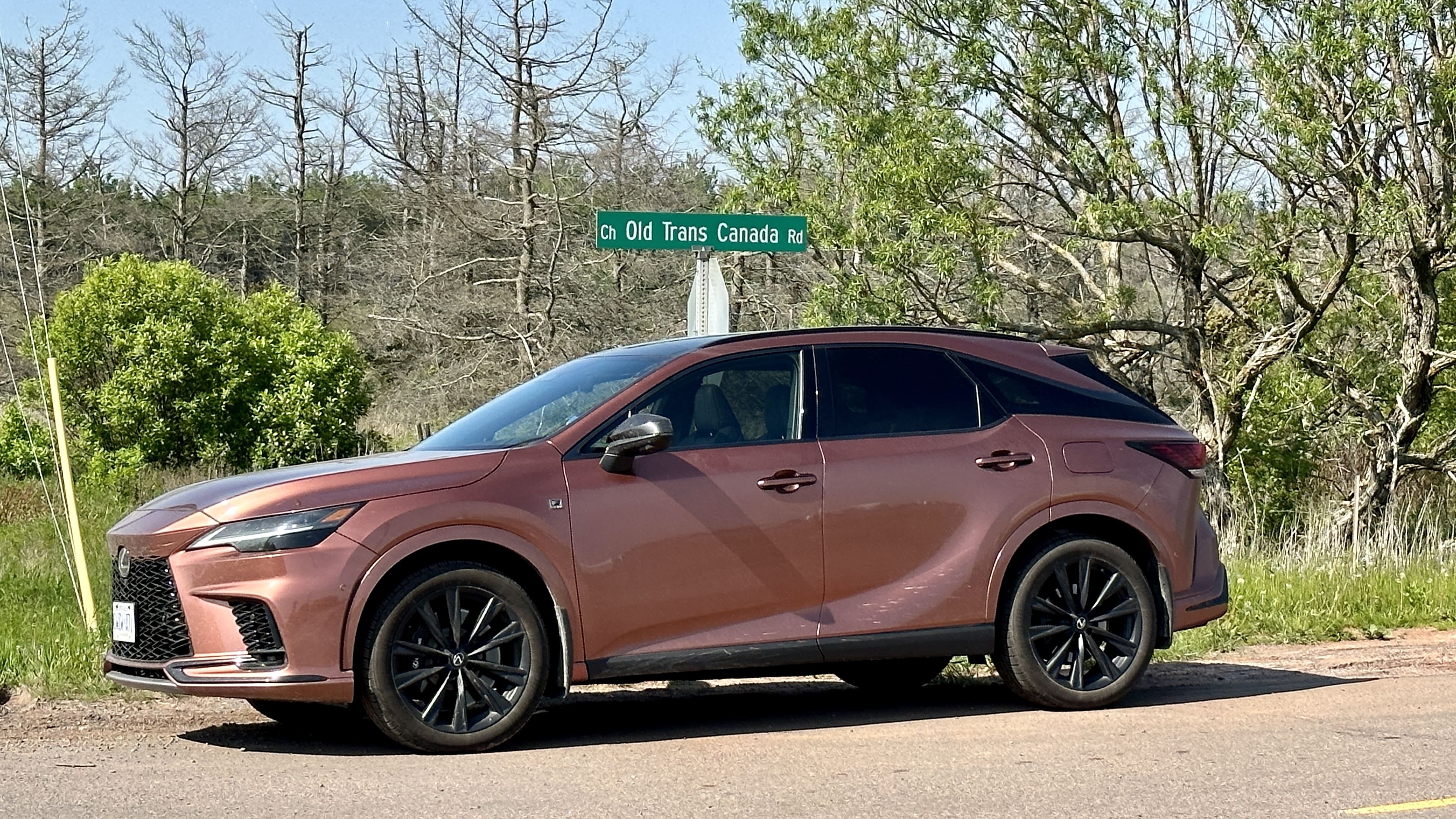
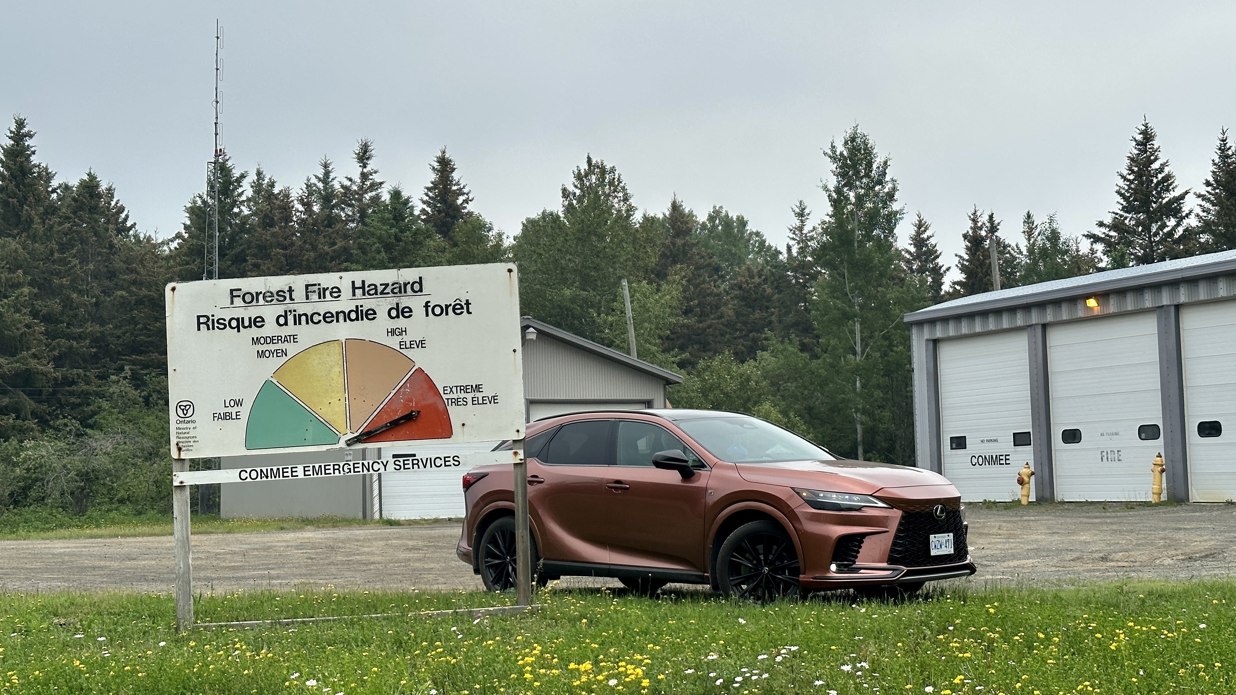
Last month, I drove a Lexus RX 500h the length of the Trans-Canada Highway along the 7,800 kilometres of its traditional route, to determine whether it still deserves its iconic national status. It seemed fitting to do so: I was born on the same day – I believe, at the exact hour – that the premier cut a ribbon to open the highway, allowing an estimated 347,000 people to drive through the national park before the prime minister’s ceremony.


Left: The Lexus RX 500h in PEI.
Right: The Lexus RX 500h in northern Ontario.
I carried some mementoes of the past, as I did when I first drove the highway in 2012. A horseshoe lent to me by the St. Catharines Museum, picked up along the way for luck by Jack Haney in 1912, when he and Thomas Wilby made the first attempt to drive across Canada, before maps and proper roads. A tin CAA grill badge from 1925, given to me to commemorate the cross-country drive that year of its founder Perry Doolittle, who fitted train wheels to his Model-T Ford to cover more than 1,300 kilometres on railway tracks where there were still no roads. And the Todd Medal, finally awarded in 1946 to the first person to ever drive across Canada on Canadian roads all the way, Brig. Alex Macfarlane, lent to me by his family.

The horseshoe, CAA crest, and Todd medal.Mark Richardson/The Globe and Mail
“Most people have no idea about how difficult it used to be” to travel by road, said David Hooper, over lunch near his home at Port Alberni on Vancouver Island. He’s a retired schoolteacher, and a volunteer with the local Industrial Heritage Society. We’d just come from the Alberni Valley Museum, where he posed for a picture with the original signpost that declared the start of the “Canadian Highway” in 1912, when it was still just a dream of the Good Roads Society. Our twentysomething server had no idea that hundreds of people had gathered in her hometown more than a century ago to press for it to be the western terminus of the national highway.

David Hooper at the local museum in Alberni with the original 'Canadian Highway' sign from 1912.Mark Richardson/The Globe and Mail
“When I think about it, I think of how optimistic they were,” Hooper said. “They really were optimistic, and I don’t think we’re really so optimistic any more. They were off on a great adventure – a great enterprise.”
A couple of days earlier, I’d met an Ontario couple staying at my motel who were driving a Honda Civic coupe across Canada. They love driving. Phil Duprey and Teresa Willett drove recently to Halifax, N.S., and they plan to drive across Newfoundland next year. This summer, however, they’d carried the ashes of Willett’s grandmother along the Trans-Canada Highway to Vancouver Island to sprinkle in Nanoose Bay.
“I definitely want to do all of it, from Zero to Zero,” said Willett. (Both St. John’s in the east and Victoria in the west consider themselves to be Mile Zero of the Trans-Canada, making it, as journalist Walter Stewart once observed, a highway with two beginnings and no end.)


Left: The Trans-Canada Highway near Terrace Bay, Ont.
Right: Teresa Willett and Phil Duprey with their 2017 Honda Civic coupe in Kamloops, B.C.
“I’m a proud Canadian,” added Duprey. “The Trans-Canada was a bucket list [item] for me. It’s something I’ve always wanted to do. The Trans-Canada is like the Route 66 of my country. I just kind of want that nostalgia.”
They’d been getting nostalgia, too. “Our air-conditioning died in Sudbury,” said Willett, “so we’ve been driving this old school – windows down, yelling to each other, music cranked.”
We talked about the scenery we’d seen along the way: the majesty of the mountains, the big sky of the prairie, the beauty of the coastlines and, above all, the sheer scale of the rocks and trees and seemingly endless ribbon of asphalt that connects it all.
@globedrive Mark Richardson is driving the #transcanadahighway here is goes over the Rogers Pass. These intersecting arches mark where Prime Minister John Diefenbaker declared the road opened n Sept. 3, 1962. #roadtrip ♬ original sound - Globedrive
But the Trans-Canada Highway, like the country it crosses, seems to be never quite sure of its purpose. Sometimes, as in Quebec and New Brunswick, it’s an expressway with separated lanes and controlled access interchanges, like an American interstate. At other times, as with long stretches through Ontario and British Columbia, it’s the tourist road less travelled, where trucks prefer alternative routes south of the border and there are pullouts for vistas every five minutes.
Personally, I hold to the idea of the Trans-Canada of Newfoundland, where the islanders think of it as the road that connects every part of their province and, by happenstance, will take them on the ferry west to the rest of Canada.

Joe Roberts in his garage in Badger, Nfld.Mark Richardson/The Globe and Mail
In Badger, central Newfoundland, I chatted with Joe Roberts, who walked four times across the province in the 1990s to raise money for the hospital where his son had been a patient. His house was close to the highway – the closest of any of the homes in Badger. He could turn right out of his driveway and walk 450 kilometres to St. John’s, or turn left and drive more than 7,000 kilometres to Vancouver, as he and his wife had done several times.
“I like it like that,” he told me, sitting in his garage and looking out at the road. “Helps me feel a part of things. Helps me feel like a part of Canada.”
Mark Richardson is the author of Canada’s Road: A journey on the Trans-Canada Highway from St. John’s to Victoria (Dundurn).
Read more in this series:
A bridge, a ferry and a dot-matrix printer: Driving the Trans-Canada highway through the Maritimes
Stay on top of all our Drive stories. We have a Drive newsletter covering car reviews, innovative new cars and the ups and downs of everyday driving. Sign up today.