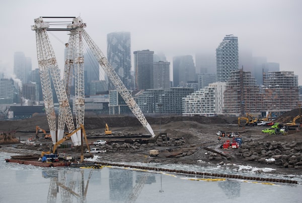
Canoe Cove and Promontory Park, part of the Port Lands redevelopment project, seen from an observation platform on Cherry St. on Jan. 25.Fred Lum/The Globe and Mail
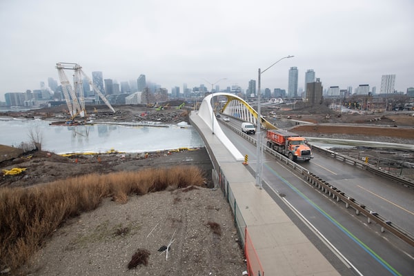
As sleet lashed the struts of a new bridge, two construction workers moved a sign out of the way, and the new Cherry Street was open.
This small event on Wednesday was an important milestone for the revitalization of Toronto’s Port Lands – a huge, visionary project that is inching toward completion next year.
This $1.25-billion effort involves, quite literally, building a new river. It will reshape Toronto’s physical and social geography. By contrast, the street design and urban design of this area are distressingly pedestrian.
After Wednesday’s opening, you can see the flood protection work happening. Cross the new Cherry Street North Bridge – actually two bridges, elegantly spun twists of white and red steel designed to hold vehicle, cycle and pedestrian traffic and a future LRT. From here, turn left onto a newly opened Commissioners Street, and see the meandering bed of the Don River weave through 25 hectares of new parkland.
Fred Lum/The Globe and Mail
A wide perspective of the Port Lands project. A new river will flow through a naturally landscaped area taking water from the Don River to Lake Ontario.Patrick Dell/The Globe and Mail
This is the Port Lands Flood Protection Project, led by landscape architects Michael Van Valkenburgh Associates (MVVA) and built by EllisDon. After roughly five years of work, this gargantuan effort has delivered a very recognizable river lined by wetlands and criss-crossed by pedestrian paths. Now it’s visible. “That’s one reason this is an important milestone for us,” said David Kusturin, chief project officer at the public agency Waterfront Toronto. “Now everyone can see what we’ve been up to.”
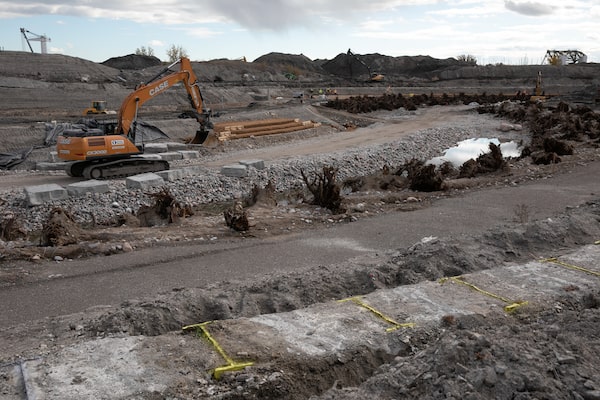
This year, water will begin to flow here, connecting the existing Don River with the lake. The point is to provide flood protection for nearly 600 acres of downtown Toronto. MVVA’s brilliant design, which won a competition in 2007, was to give the Don three different ways to run: along the existing, hard-sided Keating Channel, the large new valley lined by wetlands and a bonus “spillway.” This project integrates hydrology, geotechnical engineering and landscape architecture at a high level, and it is globally significant in its bigness and brio. Usually, only gods get to work on this scale.
It proves that Toronto can build big things, and that different governments can come together. Waterfront Toronto, which leads the project, is a joint venture of the city, the province and the federal government.
Fred Lum/The Globe and Mail
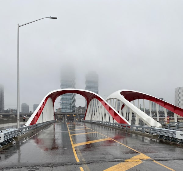
The new Cherry St. Bridge South, top, and Cherry Street Bridge North at Toronto’s Port Lands project pictured in January.Alex Bozikovic/The Globe and Mail
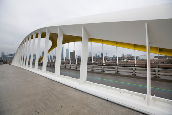
The high points of the design so far are the new bridges. There are four, with two others, similar in form but accented with yellow and orange, along Cherry Street and Commissioners Street – and they are beautiful objects. Designed by London architects Grimshaw with Entuitive and Schlaich Bergermann, these are elegantly sculpted, well-lit and lined with wooden handrails.
But there are causes for concern. The new streets are an enormous 40 metres wide. Created by landscape and architecture firm DTAH and engineers WSP, they include lanes for vehicle traffic. And bike lanes. And very wide sidewalks. And space for a planned LRT. All these well-intended ingredients add up to a sprawling expanse of asphalt and concrete, with surprisingly few trees. There are planting beds, whose occupants will likely die of neglect from the city’s abysmal maintenance practices. And the new benches on these streets are all of the same design, in which you sit on a beam of heavy timber. This appears to violate the city’s own accessibility guidelines.
This reconstructed area, known as Villiers Island, is meant to be an urban neighbourhood that’s climate-positive and encourages walking and cycling. In Toronto, nobody in government seems to understand that such movement becomes less pleasant when a street is too wide. These new streets will feel empty and vague. Waterfront’s own design review panel complained about this years ago, apparently to no effect.
Alex Bozikovic: Toronto’s new co-op housing points to a dense, beautiful future
The urban design plan for the Villiers neighbourhood, likewise, has problems. First completed six years ago, it showed a grid of short buildings on too-wide streets. Right now Waterfront Toronto is revising this plan to add about a third more density in a handful of highrises. But even then, the proposed densities are far lower than they could be, and will likely not support much affordable housing.
To make an affordable rental project in Toronto these days, the economics demand more density. The City of Toronto just announced such a project with 34- and 43-storey towers.
On this blank urban canvas, Waterfront should take a bold approach, which means much narrower streets and much bigger buildings. The public sector is delivering a huge, innovative and beautiful piece of infrastructure here, almost literally moving mountains, on one of the best sites in the country. It would be a shame to waste their effort.
 Alex Bozikovic