
Coastline in the Northwest Territories erodes into the Beaufort Sea. Rising sea levels and melting ice are worrying threats to infrastructure in the North, not just on the coasts, but in all communities where permafrost is thawing faster than usual, putting buildings in danger of collapse.Courtesy of the Geological Survey of Canada
The escarpment along the western edge of Fort McPherson, a small hamlet of 700 in the Northwest Territories, cracks and sloughs away amid some of the warmest years on record. The community’s senior administrative officer, Bill Buckle, says residents worry a health centre and church are at risk of damage or collapse, along with the RCMP detachment and Northern Store.
In Tsiigehtchic, a hamlet of fewer than 200 about 60 kilometres to the east, two iconic churches rise above the confluence of the Mackenzie and Arctic Red Rivers, plus an adjacent cemetery. An assessment conducted a decade ago found that all of that site, known as Church Hill, is at risk of being lost to landslides – a fate that, year by inexorable year, is slowly being realized.
Further south, in the oil town of Norman Wells, Mayor Frank Pope worries about his community’s main road, which runs the length of the community and carries heavy traffic. Part of it is built atop a rapidly eroding riverbank. “We’re going to have to go through a major rebuilding – or maybe even rerouting – program in the next five years,” he says.
Scenes such as these are cropping up across the Northern regions because permafrost – the foundation of ice on which much of the Arctic rests – is thawing at an accelerating rate. Fort McPherson, Tsiigehtchic and other communities in the northern Mackenzie delta are experiencing these problems earlier than most, partly because the region is warming even faster than elsewhere in the Arctic.
Virtually every credible authority on the Arctic is in agreement: More permafrost will thaw as temperatures continue to rise. And that will have serious implications for roads, airstrips, homes, schools, pipelines, water and wastewater facilities built on it.
“It’s a bigger issue here than I think people realize,” Mr. Pope said. “The firm, icy base that we built our communities on is eroding.”
This realization is prompting a rethinking of Northern living.
Municipalities and territorial governments are mapping permafrost so they can make better choices about where to build. Engineers and standard-setters are devising new ways to build on it, while saving as many existing structures as possible. Various techniques exist to protect permafrost, and more than a few of them are astonishingly simple and obvious.
The bad news is that many of these techniques add to the already high costs of living and building in Canada’s North. Collectively home to more than 100,000 people, these communities are small and remote, with limited tax revenues, and they rely on higher levels of government to fund major projects.
According to a 2015 study by the Northwest Territories Association of Communities, its 33 members can expect permafrost-related damages of between $1.2-billion and $1.4-billion in the years ahead – approximately one-quarter of the total value of the affected assets. Who will pay for all these unexpected new costs?

NORTHERN CANADA’S FOUNDATIONS
ARE WASTING AWAY
The temperature of permafrost, which lies beneath an estimated 40% of Canada’s land mass, has increased during the last three or four decades. The nation’s official permafrost map, published in 1995, delineates the North into sprawling regions.
PERMAFROST TYPE
Isolated
Continuous
Subsea
Extensive discontinuous
Sporadic discontinuous

NORTHERN CANADA’S
FOUNDATIONS ARE
WASTING AWAY
PERMAFROST TYPE
Continuous
Extensive discontinuous
Sporadic discontinuous
The temperature of permafrost, which lies beneath an estimated 40% of Canada’s land mass, has increased during the last three or four decades. The nation's official permafrost map, published in 1995, delineates the North into sprawling regions.
Isolated
Subsea

Thawing permafrost alters landscapes
and threatens infrastructure built on it,
such as roads, buildings and pipelines.
The extent of that threat depends
on permafrost characteristics, which can
vary greatly even over small areas.
Continuous
Active
layer
Discontinuous
Sporadic-isolated
MATT MCCLEARN, JOHN SOPINSKI AND MURAT YÜKSELIR
source: Natural Resources Canada, GRAPHIC NEWS

Thawing permafrost alters landscapes and threatens infrastructure built on it, such as roads, buildings and pipelines. The extent of that threat depends on permafrost characteristics, which can vary greatly even over small areas.
Continuous
Discontinuous
Sporadic-isolated
Active
layer
MATT MCCLEARN, JOHN SOPINSKI AND MURAT YÜKSELIR
source: Natural Resources Canada, GRAPHIC NEWS
UNCERTAIN GROUND
The main road through the town of Norman Wells runs parallel to the Mackenzie River. Mr. Pope, the mayor, says it was built some distance from the riverbank, which is about 12 metres tall in places. Rapid erosion is threatening the road leading to the community’s easternmost subdivision.
Mr. Pope believes the underlying permafrost is to blame. In 2019, the town drilled along the river bank and road to assess its condition. “We discovered that a lot of the permafrost is 12 feet [3.7 metres] down – that’s where it starts,” Mr. Pope said. The last time surveys were conducted, several years ago, it was only one metre below the surface. Buildings are becoming more unstable, the mayor adds – probably because too many were built on foundations that couldn’t accommodate rapid thawing. “We didn’t think far enough ahead,” he said. “I don’t think government in general has given enough consideration to how fast this is happening in the North.”
Researchers monitor ground temperatures using boreholes scattered across the North, some as deep as 20 metres. Laval University engineering professor Guy Doré has been watching Salluit, Que., in the Eastern Arctic, since the late 1990s. Back then, the temperature of the ground about a dozen metres below the surface was -8 C. Now it’s -4. “It’s happening very fast,” he said.
This rapid warming by no means implies that Canada’s permafrost is on the verge of extinction. Just as it took decades or even centuries to form permafrost, it takes a lot more than a few warm summers to ruin it. “It takes something like 1,000 times more heat to thaw the ground compared to raising the ground temperature by one degree Celsius,” Dr. Doré said. “It’s going to take thousands of years for permafrost to disappear.”
But problems can occur well before ground ice turns to water. “Permafrost at minus a half a degree can actually be a lot less strong than permafrost at minus two,” said Antoni Lewkowicz, a professor of physical geography at the University of Ottawa who studies how climate change affects permafrost. “Permafrost will lose its strength in many places, and structures that are built on it will suffer as a result.” Just how bad those effects will be depends on local permafrost conditions, which vary greatly among – and even within – communities. “All the buildings in Inuvik are built on permafrost,” Dr. Lewkowicz said. “So if you start to get permafrost thaw there it’s going to affect the whole community.”
Further south, where permafrost is less prevalent, most communities don’t rely on it to the same extent, even if their permafrost may be warmer and thawing more quickly.

The main street in Inuvik, NWT, as seen in 2008. At these latitudes, many structures are built over permafrost.Jonathan Hayward/The Canadian Press
The effects also depend greatly on past decisions. History has shown that when infrastructure is built without due consideration of local permafrost conditions, bad things will follow.
The Geological Survey of Canada (GSC), part of the federal Natural Resources Department, is studying how and why permafrost is changing across wide swaths of the north, including along transportation corridors.
Research scientist Stephen Wolfe said many unintended consequences result when people build on poorly considered landscapes, disturbing ground or vegetation that previously protected underlying permafrost from accelerated decay.
Dr. Wolfe said the experience of the Yellowknife Highway (officially Northwest Territories Highway 3) is instructive. First completed in 1960 as a gravel and dirt road, it snaked through the terrain and was built on a high embankment. GSC research found that this approach preserved the permafrost.
But the highway was straightened to allow faster travel during the 1990s and early 2000s, crossing less ideal terrain.
“A lot of water will now accumulate into and under the highway, and it melts the ground ice,” he said. “And within a few years they were seeing 50 centimetres to a metre of subsidence in the highway.” (Land subsidence is sinking of the ground due to the movement of underground material.)

This section of the Dempster Highway from Inuvik to Yukon collapsed in 2009 due to melting permafrost.Rick Bowmer/The Associated Press
Poor choices have also caused buildings to fail. Ross River, a small community of about 350 in south-central Yukon, is built on ground ice that is 20 metres thick in some locations; large portions of it are believed to be on the brink of thawing. Completed in 2001, its school’s foundation consists of a steel frame on concrete pilings; thermosiphons, systems that transfer heat from the ground beneath buildings into the air, were placed about two meters underground to keep the ground cool.
But that system performed poorly, and a heated crawlspace beneath the school made matters worse. According to a 2016 report by the Northern Climate Exchange, the school suffered extensive damage: Concrete pilings cracked and deformed; inside the school, cracks spread across drywall and floors. A window in the library fell from its frame. This led to extensive repairs in 2015, yet the school’s future remains uncertain. The Yukon government had considered installing a new cooling system, but shelved that plan when the only tender it received was considerably higher than budgeted.
For now, that’s not typical. Dr. Lewkowicz, from the University of Ottawa, said he toured Inuvik in late 2018 looking for evidence of failing buildings. He didn’t see any.
“It’s not like you visit a community and see dozens and dozens of buildings falling apart,” he said. “The cost is more in terms of maintenance of buildings that might be suffering some stress, rather than wholesale destruction.”
“It’s not catastrophic by any means in the short term,” agreed Sara Brown, chief executive of the Northwest Territories Association of Communities. In the Mackenzie delta, “they’re seeing more jacking, and more differential settlement for sure. They’re not seeing buildings collapse or anything like that yet.
“But it’s coming,” she warned. “It’s going to be huge.”

That sinking feeling
NUN.
Detail
This 2016 map identifies areas in Arviat,
Nunavut, suitable for development.
Unsuitable areas include areas showing
signs of slumping, presumably due to
thawing permafrost.
Hudson
Bay
MAN.
ONT.
QUE.
Hudson Bay
Arviat
NUNAVUT
0
1
KM
Unsuitable
Marginal
Possible
Suitable
Displacement
JOHN SOPINSKI/THE GLOBE AND MAIL
SOURCE: 3vGeomatics

NUN.
That sinking feeling
Detail
This 2016 map identifies areas in Arviat,
Nunavut, suitable for development. Unsuit-
able areas include areas showing signs
of slumping, presumably due to thawing
permafrost.
Hudson
Bay
MAN.
ONT.
QUE.
Hudson Bay
Arviat
NUNAVUT
0
1
KM
Unsuitable
Marginal
Possible
Suitable
Displacement
JOHN SOPINSKI/THE GLOBE AND MAIL
SOURCE: 3vGeomatics

That sinking feeling
NUN.
This 2016 map identifies areas in Arviat, Nunavut, suitable for
development. Unsuitable areas include areas showing signs
of slumping, presumably due to thawing permafrost.
Detail
Hudson
Bay
MAN.
Hudson Bay
ONT.
QUE.
Arviat
NUNAVUT
0
1
KM
Unsuitable
Marginal
Possible
Suitable
Displacement
JOHN SOPINSKI/THE GLOBE AND MAIL, SOURCE: 3vGeomatics
SHORING UP THE FOUNDATIONS
Craig Scott is executive director at Ecology North, an environmental organization active in the Northwest Territories. He says most communities have done little to prepare for that future.
“Most communities are doing reactive adaptation, which basically means they’re dealing with things as they become an emergency and need to be dealt with.”
The good news is that there’s much they can do, immediately, to preserve their permafrost.
Snow-removal crews sometimes pile snow around building foundations, either out of expediency, or else in an attempt to block airflow to keep floors warmer. It’s a bad idea: Snow insulates the ground, preventing the frigid winter air from chilling the permafrost. And when it melts in spring, the resulting pools of water can seriously degrade permafrost. Simply piling snow elsewhere can make a big difference.
Traditionally, many Northern communities have not required much in the way of culverts and other drainage infrastructure. But in a warming climate, many must now cope with much larger volumes of water.
Communities such Fort McPherson, NWT, and Clyde River and Kugluktuk in Nunavut have drawn up new drainage plans to get runoff out of the community faster, before it can thaw more permafrost.
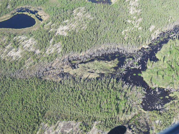
The dead trees in this area of the Northwest Territories are a sign of permafrost thaw, meaning that land isn't suitable for infrastructure.Courtesy of the Geological Survey of Canada
Traditionally, sites for new buildings and infrastructure have been selected with little regard for the underlying permafrost. That’s becoming untenable in the 21st century. Some communities are now mapping their permafrost to better understand where they should build – and where they shouldn’t.
Even with better maps, Dr. Lewkowicz said site-level geotechnical investigations will still be necessary for new buildings.
“If you don’t have any information on the ground you’re building on, it’s like being blind,” Dr. Doré of Laval University agreed. He believes the additional costs of proper site investigation. while substantial, are far less than the long-term maintenance costs resulting from that blindness.
Dr. Wolfe said the Tlicho Highway, a new all-season road to Whati, NWT, applied lessons learned from the Yellowknife Highway. He and colleagues at the GSC map landscapes around major existing and proposed transportation corridors in the North. “We were able to detect the types of terrain that had ground ice, and that was susceptible to subsidence, and recommend those areas to avoid,” he said.
For the past several years, the Standards Council of Canada has been developing new standards for Arctic construction. The Northern Infrastructure Standardization Initiative (NISI) promises to help Northern communities build and maintain their buildings, roads and drainage systems in ways that preserve permafrost rather than destroy it.
Chantal Guay, the Standards Council’s CEO, said the standards take into consideration the North’s harsh climate, the scarcity of materials available there and the fleetingly short building season.
Thermosiphons, regarded by some as a promising technology to help communities adapt, have often failed in the North because of improper design or installation. A set of NISI standards now provides guidance for employing them correctly. Other NISI standards cover community drainage and conducting site-level permafrost surveys.
The Standards Council has promoted those standards by distributing brochures in English and Inuktitut, and training people how to use them. Although voluntary, they’ve found early adopters: The Nunavut Housing Corporation, for example, recently applied the standard of geotechnical site investigations to select new locations for public housing in the communities of Cambridge Bay, Arviat and Iqaluit.
Ed Hoeve, a geotechnical engineer and consultant who has extensive experience working in the North, is one of NISI’s travelling trainers. And yet, he has seen other professionals fail to use the standards, even when they’re familiar with them. “I don’t know that the standards have made a big difference in the way that people conduct their business,” he said.
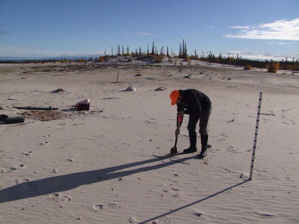
The Geological Survey of Canada remotely trained northerners to monitor permafrost sites, like this sand wedge at Whitebeach Point in the Northwest Territories.Courtesy of the Geological Survey of Canada
Yet Mr. Hoeve is confident modern technologies and techniques, particularly thermosiphons, are equal to the task. “Climate change is just one more uncertainty or variable that we need to take into account” when designing buildings and infrastructure, he said. “From the point of view of foundations, we can handle it.”
Dr. Doré pointed to techniques for protecting permafrost underneath roads. For example, one can build embankments with boulders or cobbles that encourage air circulating in winter, chilling any underlying permafrost. One can also coat road surfaces with materials that reflect more solar radiation, and thermosiphons can be used for small, particularly vulnerable road segments.
“Will it be manageable?” he asked. “In most cases, yes.”
The key obstacles to managing permafrost degradation this century, then, are not technical. They’re about money.
“This is at a scale that local governments can’t deal with, nor can the territorial government,” Ms. Brown of the Northwest Territories Association of Communities said. “What’s going to happen when we start talking about building rehabs, completely changing building methods, having to put thermosiphons everywhere? We’re going to be talking about big, big bucks.”
And therein lies a looming uncertainty: How much is the federal government prepared to spend to keep Northern living viable?
“When does government say, ‘We’re not going to throw another billion dollars into this community of 3,000, let’s just move them out of there’?” Ecology North’s Mr. Scott asked. “These are bigger questions. … Nobody really knows what the answers will be.”
Climate change’s hazards: More from Matthew McClearn

Natalie Thomas/Reuters
How open summer seas in the Arctic endanger Canada’s efforts to protect it
Tuktoyaktuk teetering: Hamlet’s shoreline erosion a warning to rest of Canada’s North
Insurers see hefty payout from severe weather in 2020
Climate change threatens Canada’s dams – but who’s keeping track?
Why Fort McMurray’s flood defences weren’t ready when the town needed them most
 Matthew McClearn