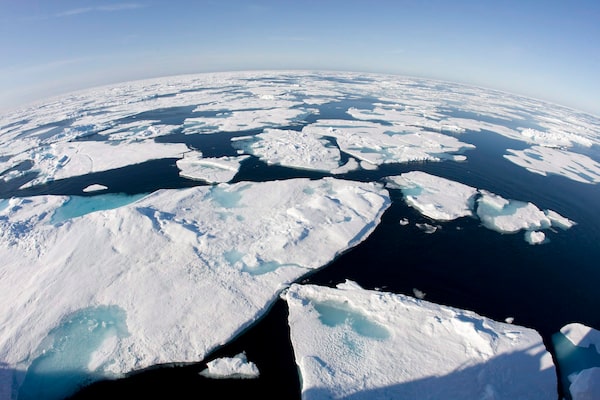
Ice patterns are seen in Baffin Bay above the arctic circle from the Canadian Coast Guard icebreaker Louis S. St-Laurent on July 10, 2008.Jonathan Hayward/The Canadian Press
Weather matters in the Arctic like it does in few other places, but Environment Canada’s forecasts for the North have long been hampered by poor data.
Now, two new “supersites” in Whitehorse, Yukon, and Iqaluit, Nunavut, should give northerners a more accurate sense of some of the country’s most extreme weather – and improve scientific understanding of the changing Arctic.
“There’s interest to understand how we can make improvements to the Arctic weather forecasts, particularly since we’re seeing such increased activity in the Arctic,” said Environment Canada researcher Zen Mariani. “We need to make sure we’re doing a good job with the Arctic weather forecasts.”
Many northerners, who like to head out on the land for days at a time in all seasons, depend on accurate predictions for safe travel.
The North is becoming a busier place. Vessel traffic in the Northwest Passage is growing, as is air traffic at the newly enlarged and renovated Iqaluit airport. Nunavut’s population is increasing – all while climate change is upending traditional knowledge about weather patterns.
Unlike southern Canada, the North has had few sites providing comprehensive, high-resolution observations for weather forecasting.
Starting about five years ago, Environment Canada began upgrading weather facilities in the two northern capitals. Modern weather radar was installed along with lidar – similar to radar but using laser light to “see” into clouds and fog banks.
The new instruments, operated remotely from the south, allow scientists to measure cloud cover, detail changes in wind speed and its direction and assess the height of water vapour above the ground.
The North presents unique challenges such as so-called stratified wind patterns. Winds at different altitudes have different directions – crucial information for pilots flying over the tundra.
Northerners hunting or travelling on the land need constantly updated information on visibility and wind speed.
The supersites are now fully operational and are feeding into regular forecasts. The data is available to the public in real time, Mariani said.
The sites are part of an international effort to better understand how Arctic weather works. Data from across the circumpolar world will help forecasters test the model they’ve been using for predictions against much more accurate and complete information on the ground.
“It’s a huge collaborative effort,” Mariani said. “Installing these instruments has provided us with the opportunity to have a very rich data set to have these model verifications.
“What things do models do well? What things do models do poorly? Where can we improve?”
Putting the supersites in Whitehorse and Iqaluit gives scientists data from two very different landscapes. Iqaluit is in the tundra and Whitehorse is nestled against the Pelly Mountains.
It’s a long way between the two. A third site would be helpful, Mariani said.
“We don’t have any immediate plans, but Yellowknife is a hot spot and would be a great location for similar research.”
Even without it, northerners can expect to get more reliable weather information before heading out, Mariani said.
“What we’re hoping to achieve are concrete tangible improvements to these forecast models.”
Our Morning Update and Evening Update newsletters are written by Globe editors, giving you a concise summary of the day’s most important headlines. Sign up today.