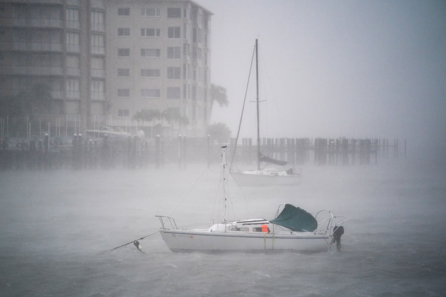
Wind gusts blow across boats in the Sarasota Bay as Hurricane Ian churns to the south on Sept. 28, 2022, in Sarasota, Fla.Sean Rayford/Getty Images
1 of 21
Here are the latest updates on Ian:
- Hurricane Ian made landfall as a Category 4 hurricane on Wednesday afternoon, with winds hitting 250 km/h, just shy of the most dangerous status.
- More than 2.5 million people were under mandatory evacuation orders in preparation for the hurricane.
- Airlines have cancelled nearly 2,000 U.S. flights as of Wednesday morning and scrapped 1,608 Thursday flights, as per FlightAware data, with American Airlines Group Inc and Southwest Airlines Co among the worst hit.
- Cuban officials said they have begun to restore some power Wednesday after Hurricane Ian knocked out electricity to the entire island. Two people are reported dead.

The forecasted path for Hurricane Ian
As of Wednesday, Sept. 28, 8 a.m. (ET)
Forecast positions
Potential track area*
Hurricane/tropical storm watch
Hurricane/tropical storm warning
W.Va.
Va.
Ky.
Sunday,
2 a.m.
N.C.
Tenn.
S.C.
Saturday,
2 a.m.
Ga.
Ala.
Friday,
2 a.m.
Thursday,
2 a.m.
Fla.
Wednesday,
8 a.m.
Gulf of
Mexico
CUBA
MEXICO
*This "cone of uncertainty" indicates the potential areas where the centre of the storm may go. The graphic does not indicate the strength of the storm.
MURAT YÜKSELIR / THE GLOBE AND MAIL, SOURCE: NATIONAL OCEANIC AND ATMOSPHERIC ADMINISTRATION

The forecasted path for Hurricane Ian
As of Wednesday, Sept. 28, 8 a.m. (ET)
Forecast positions
Potential track area*
Hurricane/tropical storm watch
Hurricane/tropical storm warning
W.Va.
Va.
Ky.
Sunday,
2 a.m.
N.C.
Tenn.
S.C.
Saturday,
2 a.m.
Ga.
Ala.
Friday,
2 a.m.
Thursday,
2 a.m.
Fla.
Wednesday,
8 a.m.
Gulf of Mexico
CUBA
MEXICO
*This "cone of uncertainty" indicates the potential areas where the centre of the storm may go. The graphic does not indicate the strength of the storm.
MURAT YÜKSELIR / THE GLOBE AND MAIL, SOURCE: NATIONAL OCEANIC AND ATMOSPHERIC ADMINISTRATION

The forecasted path for Hurricane Ian
As of Wednesday, Sept. 28, 8 a.m. (ET)
W.Va.
Va.
Ky.
Sunday,
2 a.m.
N.C.
Tenn.
Ark.
S.C.
Saturday,
2 a.m.
Ga.
Miss.
Ala.
La.
Friday,
2 a.m.
Thursday,
2 a.m.
Fla.
Wednesday,
8 a.m.
THE BAHAMAS
Gulf of Mexico
CUBA
Forecast positions
Potential track area*
Hurricane/tropical storm watch
JAMAICA
Hurricane/tropical storm warning
*This 'cone of uncertainty' indicates the potential areas where the centre of the storm may go. The graphic does not indicate the strength of the storm.
MURAT YÜKSELIR / THE GLOBE AND MAIL, SOURCE: NATIONAL OCEANIC AND ATMOSPHERIC ADMINISTRATION
Hurricane Ian explained
Hurricanes are a type of tropical cyclone, a storm with a low-pressure centre surrounded by fast-moving wind and moisture. To be classified as a hurricane, the storm needs a top wind speed of at least 119 kilometres an hour. Depending on how fast the wind is, hurricanes get a value of one to five on the Saffir-Simpson scale; Category 5 has no upper limit, so there is no Category 6 or higher. Hurricanes eventually slow down into post-tropical storms (63 to 118 km/h) and post-tropical depressions (62 km/h or less).
Hurricanes typically form when the ocean’s surface reaches 26.5 C or higher, and rising hot air turns into a spiral that keeps getting faster. Human-caused climate change makes the conditions that create hurricanes more common, and with more devastating results.

STORM SURGE (feet)
4
6
9
13
18+
5
250+
Catastrophic
4
WIND SPEED (km/h)
210
Extreme
DAMAGE
3
178
Extensive
2
154
Moderate
1
119
Minimal
980+
979
964
944
Less than
920
PRESSURE (mbars)
THE GLOBE AND MAIL, SOURCE: NOAA

STORM SURGE (feet)
4
6
9
13
18+
5
250+
Catastrophic
4
210
Extreme
WIND SPEED (km/h)
DAMAGE
3
178
Extensive
2
154
Moderate
1
119
Minimal
980+
979
964
944
Less than
920
PRESSURE (mbars)
THE GLOBE AND MAIL, SOURCE: NOAA

STORM SURGE (feet)
4
6
9
13
18+
5
250+
Catastrophic
4
210
Extreme
WIND SPEED (km/h)
DAMAGE
3
178
Extensive
2
154
Moderate
1
119
Minimal
980+
979
964
944
Less than
920
PRESSURE (mbars)
THE GLOBE AND MAIL, SOURCE: NOAA
6:24 p.m.
Ian threatens Florida’s already unstable insurance market
Florida’s property insurance market was already in peril. Now comes Hurricane Ian.
The massive storm that barreled into southwest Florida delivering catastrophic winds, rain and flooding is likely to further damage the insurance market in the state, which has strained under billion-dollar losses, insolvencies and skyrocketing premiums.
The scale of the storm’s destruction will become more clear in the coming days but there is concern it could exacerbate existing problems and burden a state insurance program that has already seen a sharp increase in policies as homeowners struggle to find coverage in the private market.
- The Associated Press
5:25 p.m.
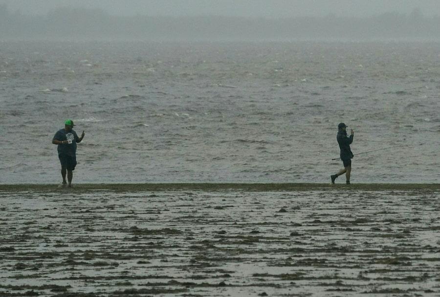
Unwilling or unable to evacuate, some Florida residents ride out Hurricane Ian
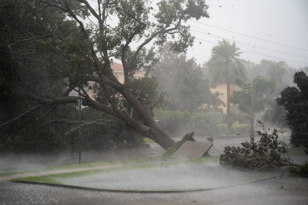
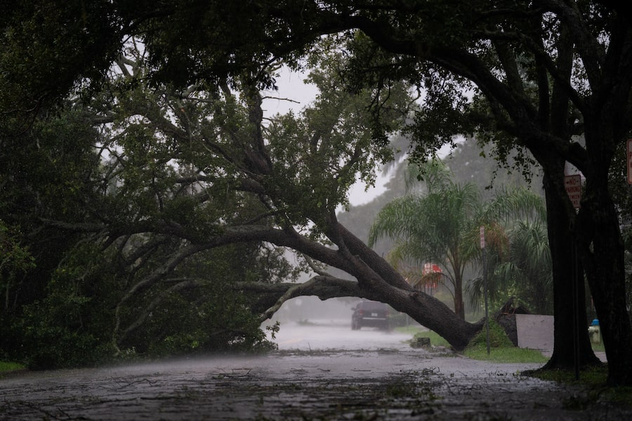
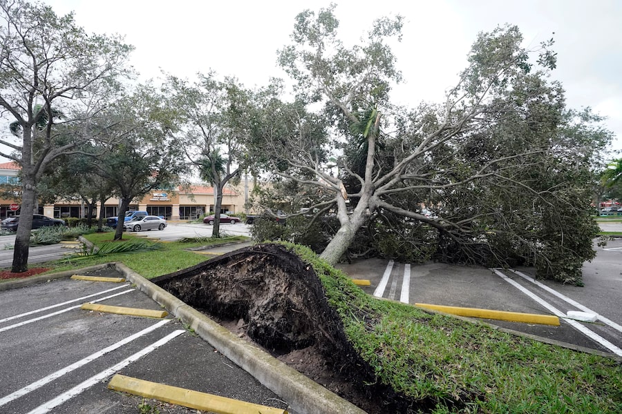
A tree is uprooted by strong winds as Hurricane Ian churns to the south on Sept. 28, 2022 in Sarasota, Florida.Sean Rayford/Getty Images
Outside the window of Susan Flack’s darkened condominium in Naples, Florida, on Wednesday, trees bent in the wind and a portable toilet floated by on rising floodwaters.
Flack, one of thousands who decided to flout official evacuation orders and ride out Hurricane Ian, was not worried about her safety. Hunkered down on the second floor of her building, where the power had been out all day and the lobby was filled with several feet of water, she took videos of the scene outside.
“Being hysterical is not going to help,” the retired attorney said in a phone interview.
Ian plowed into Florida’s Gulf Coast with catastrophic force on Wednesday, pummeling the state with howling winds, torrential rain and a treacherous surge of ocean surf that made it one of the most powerful storms on record to hit the United States.
Some 2.5 million coastal residents and others in danger zones around Tampa, Ft. Myers and nearby communities were ordered or encouraged to evacuate ahead of the massive storm. But many did not, with some simply vowing to ride it out and others unable to leave for financial or other reasons.
In Sarasota County, officials warned that emergency vehicles would not respond to calls for help until it was safe to be on the road. Those who failed to get out by Wednesday afternoon, officials said, needed to shelter in place.
“Most people heeded the warnings of doing the evacuations in those very sensitive locations, but not everyone may have done that,” Florida Governor Ron DeSantis said. Read the full story here.
– Reuters
4:41 p.m.
More than 700,000 without power, Florida Division of Emergency Management says
Florida Division of Emergency Management said it received reports of 756,450 outages, as of 3 p.m. It said personnel are on standby for restoration efforts as soon as they can be safely deployed. Poweroutage.us, meanwhile, said nearly 1.5 million utility customers had their power knocked out.
We've received reports of 756,450 outages as of 3PM EST. Our power restoration personnel remain on standby ready to get the lights on as soon as it is safe to do so.
— FL Division of Emergency Management (@FLSERT) September 28, 2022
Please continue to monitor all weather alerts & heed warnings from local officials.https://t.co/S49ep6jUOA pic.twitter.com/meEIamhUw9
– Beatrice Paez
3:20 p.m.
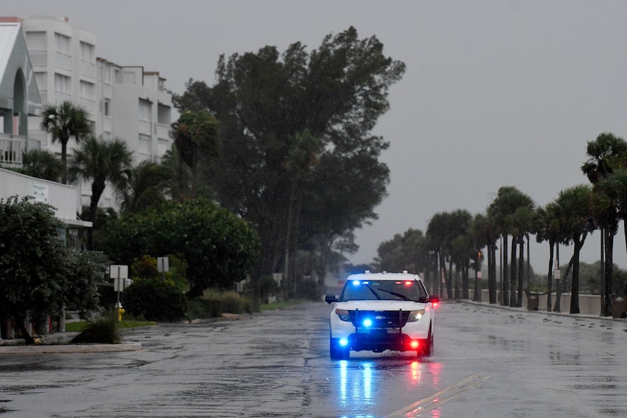
Ian makes landfall as Category 4 hurricane

Gusts from Hurricane Ian hit in Punta Gorda, Fla., on Sept. 28, 2022.RICARDO ARDUENGO/AFP/Getty Images
Hurricane Ian made landfall in southwest Florida near Cayo Costa on Wednesday as a catastrophic Category 4 storm.
About 2.5 million people were ordered to evacuate southwest Florida before the storm hit the coast with maximum sustained winds of 241 km per hour. It was heading inland, where it was expected to weaken, at about 14 km per hour, but residents in central Florida could still experience hurricane-force winds.
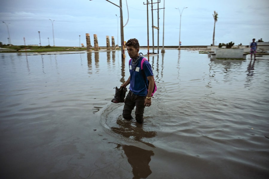
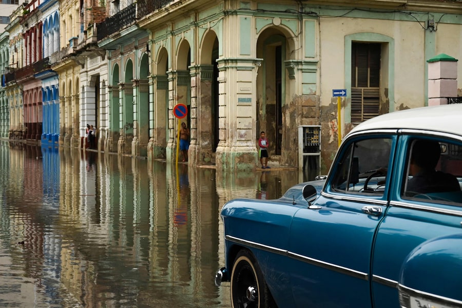
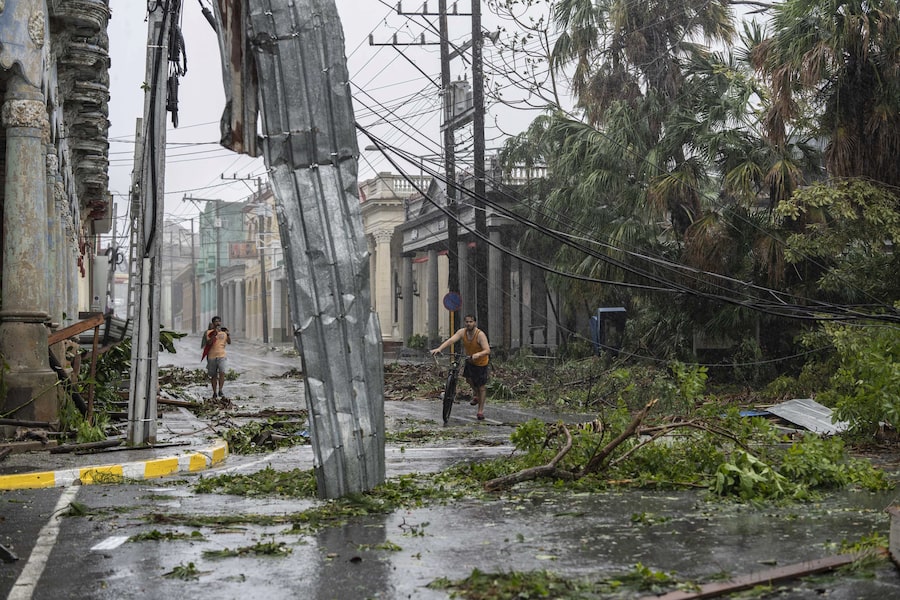
Before making its way through the Gulf of Mexico to Florida, Hurricane Ian tore into western Cuba as a major hurricane Tuesday, killing two people and bringing down the country’s electrical grid.
.@NOAA’s #GOESEast satellite captured this extraordinary imagery of #Hurricane #Ian making landfall near Cayo Costa, Florida this afternoon.
— NOAA Satellites (@NOAASatellites) September 28, 2022
Latest: https://t.co/0wCH4mn6NI#FLwx https://t.co/FX10iDGu4H pic.twitter.com/01tbXjdgZh
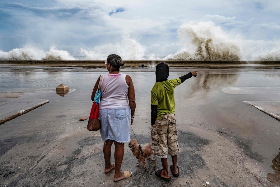
The centre of the massive Category 4 storm lingered offshore for hours, which was likely to mean more rain and damage from a hurricane that was trudging on a track that would have it making landfall north of the heavily populated Fort Myers area. Catastrophic storm surges could push 3.6 to 5.5 metres of water across more than 400 kilometres of coastline, from Bonita Beach to Englewood, forecasters warned.
– The Associated Press
3:15 p.m.
Hurricane Ian sinks Cuban migrant boat off coast of Florida; 23 reported missing
U.S. Border Patrol said on Wednesday that 23 people were missing off the coast of Florida after a Cuban migrant boat sank due to Hurricane Ian.
The Border Patrol agents responded to a migrant landing in Stock Island, Florida, officials said on Twitter, adding that the U.S. Coast Guard had initiated a search operation for the 23 missing people.
Four Cuban migrants swam to shore after their vessel sank due to inclement weather, Chief Patrol Agent Walter Slosar said. Local media said those four were hospitalized.
On Tuesday, the storm thrashed Cuba, knocking out the electrical grid for 11 million people and ravaging the western end of the island with violent winds and flooding. By early Wednesday, the state electricity provider said it had begun to restore power across the eastern end of the island.
Ian’s thrashing of Cuba left at least two people dead, both deaths occurring in the hard-hit western province of Pinar del Rio. A woman died after a wall collapsed on her and a man died after his roof fell on him, state media said.
– Reuters
2:50 p.m.
Florida ‘ready to respond’ as Hurricane Ian makes landfall, DeSantis says
Governor Ron DeSantis says Florida is “ready to respond” as Hurricane Ian makes landfall.
”We have fleets of highwater vehicles, 42,000 linemen, 7,000 National Guardsmen and 179 aircraft prepared to help.,” he tweeted.
– Emerald Bensadoun
2:40 p.m.
Biden warns oil industry against using Hurricane Ian as an excuse to raise gas prices

U.S. President Joe Biden delivers remarks in the Rose Garden at the White House on Sept. 28, 2022, in Washington, DC.Chip Somodevilla/Getty Images
President Joe Biden on Wednesday warned oil and gas companies against increasing prices for consumers as Hurricane Ian neared landfall along Florida’s southwest coast.
“Do not, let me repeat, do not use this as an excuse to raise gasoline prices or gouge the American people,” Biden said at the start of a conference on hunger in America.
Biden said that the hurricane “provides no excuse for price increases at the pump” and if it happens, he will ask federal officials to determine “whether price gauging is going on.”
“America is watching. The industry should do the right thing,” Biden added.
There are few signs that average gas prices have jumped significantly in Florida as the hurricane began to approach. AAA put the statewide average at just under $3.40 a gallon, six-tenths of a cent higher than a week ago.
– The Associated Press
2:20 p.m.
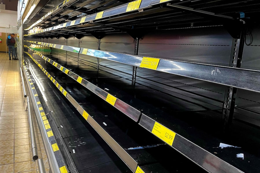
Orange juice prices surge as Hurricane Ian nears Florida

A person stands in an empty water aisle in a grocery store as people stock up on necessary items in preparation for the possible arrival of Hurricane Ian on Sep. 26, 2022, in St. Petersburg, Fla.Joe Raedle/Getty Images
Orange juice futures on ICE exchange traded up as much as 5.5 per cent on Wednesday as Hurricane Ian approached the Florida coast, threatening to damage orange trees in the country’s largest producing state.
Meat companies also braced for the storm to hit the southeastern United States, where livestock and chickens are raised, while agribusiness Cargill Inc shuttered facilities that handle products ranging from grains to salt.
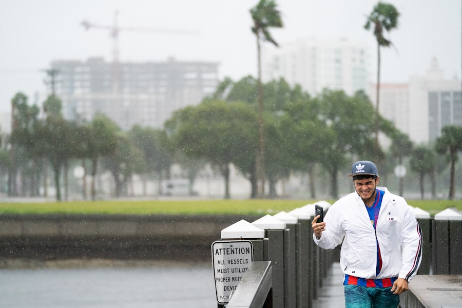
Forecasters say Ian would unleash wind-driven high surf and torrential rains that may cause coastal flooding of up to 3.7 metres in Florida. Juice futures had already gained more than 2 per cent ahead of the storm on Tuesday. Risks grew for the plantations as Ian’s path changed slightly.
“The storm shifted east and further south overnight, placing more of the oranges in harm’s way,” said Judy Ganes, a soft commodities analyst with J.Ganes Consulting.
– Reuters
2:00 p.m.
Hurricane Ian shuts 157,706 bpd of oil output in U.S. Gulf of Mexico
About 157,706 barrels, or 9 per cent of oil production in the U.S. Gulf of Mexico, were shut on Wednesday by Hurricane Ian, said offshore regulator Bureau of Safety and Environmental Enforcement.
A total of 16 oil and gas production platforms were evacuated by Ian, the regulator said.
– Reuters
1:54 p.m.
Authorities tell residents near eye of the storm it’s too late to evacuate as Ian lashes out at Florida Gulf Coast

A car drives on a bridge over the Peace River ahead of Hurricane Ian, in Punta Gorda, Fla., on Sept. 28, 2022.RICARDO ARDUENGO/AFP/Getty Images
Hurricane Ian on Wednesday began lashing Florida’s Gulf Coast with powerful winds and drenching rain, prompting authorities to tell residents it was too late to evacuate as the eye of the storm inched toward shore with close to Category 5 power.
At 11 a.m. ET, Ian was around 80 km southwest of Punta Gorda, Florida, with sustained winds of 250 km per hour, the U.S. National Hurricane Center said. That was just shy of a Category 5 designation, which is the most severe storm classification with sustained winds of at least 250 km per hour, though Ian was expected to weaken a notch after hitting land, the centre said.
– The Associated Press
1:20 p.m.
Ian forecast to move ashore Wednesday afternoon

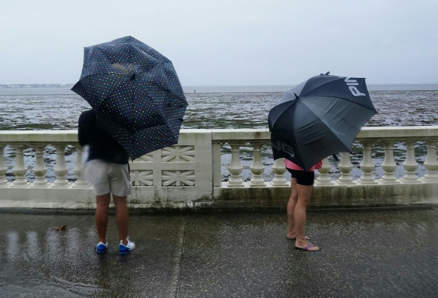
People walk on the Ballast Point Pier ahead of Hurricane Ian on Sept. 28, 2022, in Tampa.Chris O'Meara/The Associated Press
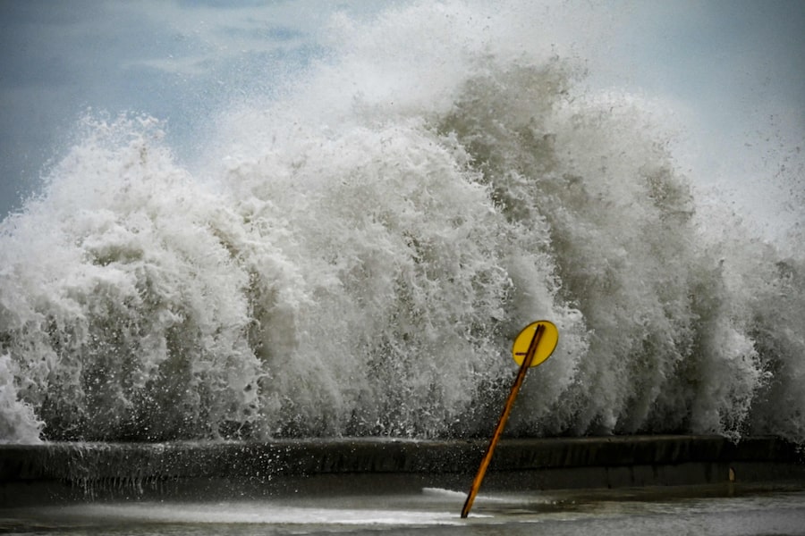
The National Hurricane Center is forecasting storm surges of at least a foot or so along virtually the entire Gulf Coast of Florida, but said the 50-mile stretch between Englewood and Bonita Beach will face the worst of it, with a current forecast of surges between 12 and 18 feet above normal sea level.
The area includes the city of Fort Myers, much of which will be inundated, the NHC predicted. The hurricane is forecast to move ashore later on Wednesday afternoon, roughly around the time that high tide comes, around 4:30 p.m.
– The Associated Press
12:45 p.m.
More than 2.5 million ordered to evacuate in preparation for Hurricane Ian

A hurricane evacuation route sign is displayed as Hurricane Ian spins toward the state carrying high winds, torrential rains and a powerful storm surge, in Punta Gorda, Fla., Sept. 27, 2022.MARCO BELLO/Reuters
Ian’s eyewall, known as the ring of thunderstorms that surrounds a storm’s eye, is moving on shore at Sanibel and Captiva Islands, according to the National Hurricane Center.
More than 2.5 million people were under mandatory evacuation orders in preparation for the hurricane, but by law no one could be forced to flee. The governor said the state has 30,000 linemen, urban search and rescue teams, and 7,000 National Guard troops from Florida and elsewhere ready to help once the weather clears.
Florida residents rushed ahead of the impact to board up their homes, stash precious belongings on upper floors and join long lines of cars leaving the shore.
Some chose to stay and ride out the storm. Jared Lewis, a Tampa delivery driver, said his home has withstood hurricanes in the past, though not as powerful as Ian. “It is kind of scary, makes you a bit anxious,” Lewis said. “After the last year of not having any, now you go to a Category 4 or 5. We are more used to the 2s and 3s.”
– The Associated Press
12:30 p.m.
More than 225,000 without power as Hurricane Ian moves toward Florida
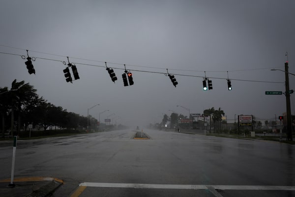
Traffic lights wave by strong gust of wind ahead of Hurricane Ian, in Fort Myers, Florida, Sept. 28, 2022.MARCO BELLO/Reuters
More than 225,000 in Florida are without power as Hurricane Ian makes it way toward the state with the near-intensity of a Category 5 storm.
As of 12:30 p.m., poweroutage.us, a site that tracks power outages, reported 225,792 homes were without electricity.
The hardest-hit areas so far appear to be near Charlotte, Sarasota and Collier counties, where the storm is forecast to make landfall later this afternoon.
– Emerald Bensadoun
12:00 p.m.
Florida Division of Emergency Management advises against walking out into receding water during hurricane
The Florida Division of Emergency Management is advising residents against walking out into receding water in Tampa Bay or Charlotte Harbor – areas which are expected to be heavily impacted by Hurricane Ian.
“The water WILL return through storm surge and poses a life-threatening risk,” the division tweeted.
– Emerald Bensadoun
11:20 a.m.
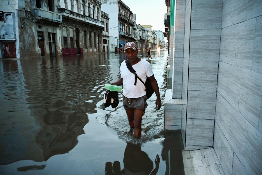
Cuba begins to turn on lights after Hurricane Ian blacks out island; at least 2 reported dead

People use the light from their cell phones as they meet in a park in Havana during a blackout, on Sept. 27, 2022.YAMIL LAGE/AFP/Getty Images
Cuban officials said they had begun to restore some power Wednesday after Hurricane Ian knocked out electricity to the entire island while devastating some of the country’s most important tobacco farms when it hit the island’s western tip as a major storm.
At least two people were reported killed.
The Energy and Mines Ministry announced it had restored energy to three regions by activating two large power plants in Felton and Nuevitas and was working to get others back on line.
Lights started to flicker on in the capital, Havana, but much of the city and other parts of western Cuba remained without power on Wednesday in the wake of the major hurricane, which had advanced northward to Florida. It was the first time in memory – perhaps ever – that the whole island had lost power.
– The Associated Press
11:10 a.m.
Hurricane Ian nears Florida landfall with 250 kph winds

People look from Bayshore Boulevard as the tide recedes from Tampa Bay as Hurricane Ian approaches on September 28, 2022, in Tampa, Florida. - Ian intensified to just shy of catastrophic Category 5 strength Wednesday as its heavy winds began pummelling Florida, with forecasters warning of life-threatening storm surges after leaving millions without power in Cuba. (Photo by Bryan R. Smith / AFP) (Photo by BRYAN R. SMITH/AFP via Getty Images)BRYAN R. SMITH/AFP/Getty Images
Hurricane Ian rapidly intensified as it neared landfall along Florida’s southwest coast Wednesday morning, gaining top winds of 155 mph (250 kph), just shy of the most dangerous Category 5 status. Damaging winds and rain lashed the state, and forecasters said the heavily populated Fort Myers area could be inundated by a storm surge of up to 18 feet (5.5 metres)
Air Force hurricane hunters confirmed Ian gained strength over warm Gulf of Mexico water after battering Cuba, bringing down the country’s electricity grid and leaving the entire island without power. Ian was centred about 60 miles (95 kilometres) west-southwest of Naples at 10 a.m., swirling toward the coast at 10 mph (17 kph).
“This is going to be a nasty nasty day, two days,” Florida Gov. Ron DeSantis said early Wednesday, stressing that people in Ian’s path along the coast should rush to the safest possible shelter and stay there.
– The Associated Press
Our Morning Update and Evening Update newsletters are written by Globe editors, giving you a concise summary of the day’s most important headlines. Sign up today.